
The Importance of Underground Utility Mapping for Construction Projects

Beneath our bustling cities and quiet towns lies a network of intricate infrastructure that transports essential resources, including water, natural gas, and petroleum. The complexity of managing this network requires a comprehensive approach—one that delves into the specifics of underground utility mapping. In this article, the vital role of underground utility mapping is discussed, narrowing down the challenges and advanced techniques that make it vital, especially when it comes to the management of pipelines.
The Pipeline Landscape
Pipelines are frequently overlooked in above-ground happenings but are indispensable to modern infrastructure. Their importance cannot be overstated, as they carry crucial resources that fuel daily life.
However, the challenge lies in managing this complex grid, where accurate information about the location, type, and condition of pipelines is critical.
In practice, that accuracy isn’t just helpful—it’s foundational to safety, cost control, and compliance across every stage of design, excavation, and maintenance.
Underground Utility Mapping for Pipelines
Accurate knowledge of what lies beneath the surface is essential for safe and efficient construction, excavation, and infrastructure maintenance.
Underground utility mapping provides detailed information about buried assets, helping prevent accidents, reduce costs, and ensure compliance.
While many companies offer general utility locating, American Pipeline Solutions (APS) specializes in pipeline utility mapping—delivering the precision and expertise needed to manage the nation’s most critical infrastructure.
Our approach aligns with Subsurface Utility Engineering (SUE) best practices that reduce utility-conflict risk during design and construction.
What Is Underground Utility Mapping?
Underground utility mapping is the process of locating, identifying, and documenting assets hidden beneath the ground. These can include water and sewer lines, electrical cables, gas lines, and telecommunication conduits.
Mapping creates a visual record of where utilities are located, allowing contractors and engineers to work safely and efficiently.
At APS, our focus goes beyond general utility locating. We emphasize pipelines—the essential conduits that transport water, gas, petroleum, and other resources that fuel communities and industries.
Because pipelines carry such high risk and responsibility, they require specialized mapping solutions that support long-term safety, compliance, and operational efficiency. That includes documenting SUE Quality Levels (A–D) appropriate to each project’s risk profile and design requirements.
Which Utilities Need Underground Mapping?
Many types of utilities benefit from accurate underground mapping. Water mains, sewer systems, electric lines, and telecom cables all require documentation to reduce the chance of damage during construction or excavation.
However, pipelines stand apart. The consequences of pipeline strikes—whether involving water, gas, or petroleum—are far more severe than damage to most other utilities.
Accidental hits can result in hazardous leaks, environmental contamination, costly service disruptions, or even catastrophic accidents. That is why pipeline mapping is one of the most critical steps in construction planning and infrastructure management.
APS provides dedicated pipeline utility mapping services that safeguard projects while protecting communities and natural resources.
Pipeline Experts: Inspection, Cleaning, Coating & More
Certified solutions for inspection, pre-commissioning, cleaning, internal coating, ice pigging™, mapping, and turnkey pipeline projects—maximizing safety and reliability at every stage.
Importance of Underground Utility Mapping for Pipelines
Preventing Accidents and Damage
The discreet nature of pipelines makes them vulnerable to accidental damage during construction and excavation activities, and underground utility mapping stands as the first line of defense.
It provides precise information about the location of pipelines and other important utilities. This knowledge helps construction teams avoid unintentional interference, preventing costly repairs and potential environmental disasters.
In addition to preventing damage, underground utility mapping aids in cost savings and efficiency improvements. By knowing the location of utilities before commencing a construction project, companies can plan their work more effectively.
This includes optimizing the placement of new utilities, coordinating with existing utilities, and avoiding unnecessary excavation or rework.
Efficient Construction and Maintenance
For any construction project involving excavation, whether laying new utilities or building infrastructure, having detailed maps of pipelines is significant. This information enables construction teams to plan their activities more effectively, optimizing the placement of new utilities, coordinating with existing pipelines, and minimizing unnecessary excavation or rework.
Ensuring Regulatory Compliance
The regulatory landscape surrounding pipeline management is strict. Following these regulations is not just a legal requirement but also a commitment to safety and environmental responsibility. Accurate underground utility mapping ensures compliance with standards, safeguarding against legal penalties and reputational damage.
Advanced Techniques in Pipeline Mapping

Ground Penetrating Radar (GPR)
Ground Penetrating Radar is one of the most reliable tools in pipeline mapping. By utilizing radar pulses, GPR provides detailed information about the depth, location, and size of underground pipelines, helping construction companies accurately plan their activities and avoid potential conflicts. This non-destructive method is particularly valuable in areas where access is limited or in urban environments with complex infrastructure.
Electromagnetic Induction
Electromagnetic induction is used to detect metallic pipelines. By emitting electromagnetic signals and measuring their responses, this technique helps determine the depth, type, and size of pipelines. It is highly effective for planning and designing projects involving metallic conduits.
Sonar and Laser Scanning
Sonar and laser scanning, using sound waves and laser light respectively, provide alternative approaches to pipeline mapping. These methods are particularly useful in areas where traditional techniques face challenges, such as bodies of water or regions with high interference. They also allow for highly accurate 3D models of underground utilities that integrate directly into engineering workflows.
Why Pipeline Utility Mapping Matters?
The importance of accurate pipeline utility mapping cannot be overstated. One of the greatest risks during construction and excavation is accidental interference with buried infrastructure.
Mapping prevents such incidents by ensuring construction teams know exactly where pipelines are located before work begins.
Utility mapping also reduces costs by eliminating unnecessary excavation, minimizing rerouting, and avoiding expensive emergency repairs.
For project managers, this means improved timelines, better resource allocation, and fewer unexpected setbacks.
Another crucial benefit of pipeline mapping is compliance. The regulatory landscape for pipelines is strict, requiring operators to meet federal, state, and industry standards.
Accurate mapping supports these requirements, helping organizations avoid legal penalties while upholding their commitment to safety and environmental responsibility.
Finally, mapping strengthens asset management. By maintaining detailed records of pipeline locations and conditions, operators gain insights that support preventative maintenance, lifespan predictions, and long-term system efficiency.
Key Benefits of Underground Pipeline Mapping
The first and most important benefit of pipeline mapping is safety. Preventing accidental damage during construction protects workers, communities, and the environment. It also minimizes liability and ensures the integrity of essential resources.
Cost savings are another major advantage. Projects that begin with accurate utility data avoid costly rework, reduce downtime, and stay on schedule. Mapping creates efficiency by allowing project teams to plan excavation and construction with confidence.
Accurate mapping also improves communication and coordination among stakeholders. Contractors, engineers, inspectors, and utility owners all benefit from having a shared, up-to-date map of underground pipelines. These records serve as critical references for future construction, renovation, or maintenance projects.
Advanced Utility Mapping Methods APS Uses
At APS, we employ a range of advanced technologies to ensure precision in every mapping project.
Ground Penetrating Radar (GPR)
GPR uses radar pulses to create detailed images of underground utilities. It is a non-destructive technique that provides accurate data about pipeline depth, size, and location, making it one of the most reliable tools for pipeline mapping.
Electromagnetic Induction
Electromagnetic technology is particularly effective for detecting metallic pipelines. By sending electromagnetic signals through the ground and analyzing their responses, APS can determine both the location and characteristics of buried pipelines.
Acoustic and Sonar Technology
When soil or water conditions limit radar accuracy, acoustic and sonar techniques are used. These methods rely on sound waves to detect pipeline locations, providing valuable data in environments where other approaches may fail.
Laser Scanning and 3D Modeling
APS uses laser scanning and 3D modeling to create high-resolution digital representations of underground utilities. These models offer exceptional clarity and accuracy, supporting detailed project planning and integration with engineering systems.
Potholing and Vacuum Excavation
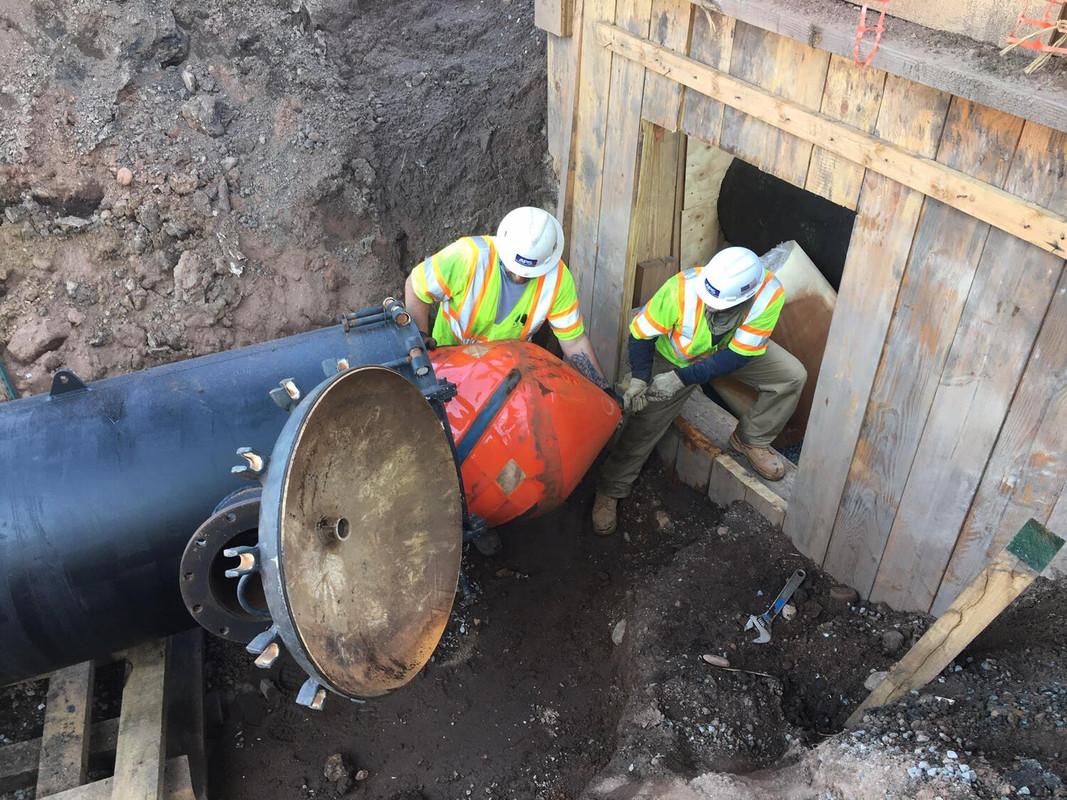
In projects requiring the highest level of precision, APS performs potholing or vacuum excavation. By physically exposing a pipeline, these methods provide direct confirmation of depth, size, and condition while minimizing disruption to the surrounding area.
GPS, GNSS, and RTK Systems
Mapping results are tied to real-world coordinates using advanced GPS, GNSS, and RTK systems. This ensures that pipeline maps are accurate, reliable, and ready to be integrated into larger project data systems.
Subsurface Utility Engineering (SUE) Quality Levels
Utility mapping is often categorized into four quality levels, each representing a degree of accuracy and reliability:
Level A: The highest assurance of accuracy, achieved through vacuum excavation. This approach provides precise location and depth information while minimizing environmental disruption.
Level B: Non-invasive geophysical techniques, such as GPR and electromagnetic locators, identify pipelines with a high degree of confidence without physical exposure.
Level C: Existing records and surface features are surveyed to approximate pipeline locations.
Level D: The least reliable level, relying solely on historical records and available documentation.
APS applies the appropriate quality level for each project, balancing safety, compliance, and efficiency with project scope, budget, and regulatory requirements.
Challenges in Pipeline Utility Mapping
Pipeline mapping often requires overcoming significant challenges. In remote or rugged environments, access to pipeline routes can be limited, requiring specialized equipment and planning. In dense urban areas, multiple overlapping utilities create complexity that demands advanced techniques and careful analysis.
Another challenge lies in undocumented or aging pipelines. Private utilities, in particular, may not be covered by public locating services, leaving gaps in available data. APS addresses these challenges by combining cutting-edge technologies with decades of industry expertise, ensuring reliable results even in the most difficult conditions.
Challenges in Underground Utility Mapping for Pipelines
Limited Access to Certain Areas
As pipelines often cross through challenging terrains, there can be limited access. Specialized equipment may be essential to access and map pipelines in remote or hard-to-reach areas.
Complex Urban Environments
Urban environments, with their density of infrastructure, present unique challenges. The close proximity of multiple utilities requires precise mapping techniques, often involving the use of multiple sensors for comprehensive data collection.
In the complex environment of underground utility mapping, pipelines emerge as a focal point demanding careful awareness.
Accurate mapping not only prevents accidents and damages but also ensures efficient construction, ongoing maintenance, and compliance with stringent regulations.
As technology advances, the tools and techniques available for pipeline mapping will play an increasingly vital role in managing these hidden conduits that form the backbone of our modern infrastructure. Welcoming the challenges and maximizing advanced mapping methods, we navigate the depths to secure the future of pipeline management.
Pipeline Experts: Inspection, Cleaning, Coating & More
Certified solutions for inspection, pre-commissioning, cleaning, internal coating, ice pigging™, mapping, and turnkey pipeline projects—maximizing safety and reliability at every stage.
Why Choose APS for Pipeline Mapping
American Pipeline Solutions is not a general utility locator. We are pipeline specialists, with expertise that extends beyond mapping into inspection, pigging, coating, pre-commissioning, and condition analysis. This integration allows us to deliver a comprehensive service unmatched by most competitors.
As a PPSA-member company, APS brings credibility and industry leadership to every project. We provide services nationwide, partnering with oil, gas, water, and industrial sectors to maintain the safety and reliability of critical infrastructure.
With decades of experience and exclusive partnerships in pipeline technology, APS ensures every mapping project is handled with the highest standards of safety, accuracy, and compliance. Our workflow aligns with recognized industry standards to document data quality and reduce risk throughout design and construction.
Each technique above has its advantages and limitations. The choice depends on the type of utilities, depth, and the specific requirements of the project. APS will recommend the right combination to meet your goals.
Protect Your Pipelines with APS Utility Mapping
Accurate underground utility mapping is the foundation of safe, efficient, and compliant pipeline management. By choosing APS, you gain a partner dedicated to protecting your assets, supporting your projects, and defending the future of your infrastructure.
Contact American Pipeline Solutions today to schedule a consultation and learn how our pipeline mapping services can benefit your next project.


